


BERNADOTTE Voting District, Fulton County, Illinois
About
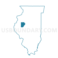
Outline

Summary
| Unique Area Identifier | 570936 |
| Name | BERNADOTTE Voting District |
| County | Fulton County |
| State | Illinois |
| Area (square miles) | 37.70 |
| Land Area (square miles) | 37.69 |
| Water Area (square miles) | 0.01 |
| % of Land Area | 99.96 |
| % of Water Area | 0.04 |
| Latitude of the Internal Point | 40.40720220 |
| Longtitude of the Internal Point | -90.27172500 |
Maps


Graphs
Select a template below for downloading or customizing gragh for BERNADOTTE Voting District, Fulton County, Illinois


Neighbors
Neighoring Voting District (by Name) Neighboring Voting District on the Map
- CASS Voting District, Fulton County, IL
- FARMERS Voting District, Fulton County, IL
- HARRIS Voting District, Fulton County, IL
- ISABEL Voting District, Fulton County, IL
- LEWISTOWN 1 Voting District, Fulton County, IL
- LEWISTOWN 2 Voting District, Fulton County, IL
- LEWISTOWN 3 Voting District, Fulton County, IL
- PLEASANT Voting District, Fulton County, IL
- PUTMAN 2 Voting District, Fulton County, IL
- VERMONT 3 Voting District, Fulton County, IL
Top 10 Neighboring County Subdivision (by Population) Neighboring County Subdivision on the Map
- Lewistown township, Fulton County, IL (3,039)
- Putman township, Fulton County, IL (2,137)
- Vermont township, Fulton County, IL (974)
- Pleasant township, Fulton County, IL (744)
- Cass township, Fulton County, IL (622)
- Farmers township, Fulton County, IL (397)
- Harris township, Fulton County, IL (368)
- Bernadotte township, Fulton County, IL (273)
- Isabel township, Fulton County, IL (192)
Top 10 Neighboring Unified School District (by Population) Neighboring Unified School District on the Map
- Lewistown Community Unit School District 97, IL (5,032)
- Fulton County Community Unit School District 3, IL (3,447)
- V.I.T. Community Unit School District 2, IL (2,259)